


The State Meteorological Agency (Aemet) has issued a forecast for Tuesday which includes light rain in the north of the islands of greater relief and possible showers and thunderstorms in the Canary Islands.
In addition, the Aemet has also warned that a drop in temperatures and northeasterly winds are expected, with intervals of strong force in the southeast and northwest slopes.
Regarding the sea conditions, a northeasterly wind of force 4 or 5 is forecast, and in some areas a wind of force 5 or 6 is expected, accompanied by swell or strong swell, with rough sea conditions in certain areas.
In the west and southwest of the islands, the wind will be variable or from the northeast, with an intensity of force 1 to 3, accompanied by breezes and swell.
A swell from the north or northeast is also forecast, with waves of 1 to 2 metres in height and a probability of showers. It is important to be aware of the possibility of storms in the Canary Islands and to be prepared for any eventuality.
POSSIBLE STORMS IN THE CANARY ISLANDS: THE WEATHER ISLAND BY ISLAND
LANZAROTE: Intervals of low, medium and high clouds are expected in Lanzarote, with the probability of occasional rainfall, mainly during the second half of the day. Rainfall will be generally light. Temperatures will remain unchanged. The wind will be northerly, with greater intensity in inland areas.
MINIMUM AND MAXIMUM TEMPERATURES FORECASTED (°C): Arrecife: 18°C (minimum) – 25°C (maximum)
FUERTEVENTURA: In Fuerteventura, intervals of low, medium and high clouds are expected, with the probability of occasional precipitation. During the first half of the day and in the early afternoon, there is the possibility of localised showers accompanied by isolated thunderstorms. Temperatures will remain unchanged or will experience a slight drop in the highs. The wind will be northerly, with occasional strong gusts.
MINIMUM AND MAXIMUM TEMPERATURES FORECASTED (°C): Puerto del Rosario: 18°C (minimum) – 23°C (maximum)
GRAN CANARIA: In the north of Gran Canaria, cloudy skies are expected with occasional showers, mainly light and more likely towards the end of the day. In the rest of the island there will be intervals of medium and high clouds, with the probability of occasional rainfall during the first half of the day. There is a possibility of localised showers accompanied by isolated thunderstorms.
Towards the afternoon, the sky will tend to be partly cloudy or clear. Minimum temperatures will remain unchanged, while maximum temperatures will experience a slight to moderate decrease inland. The wind will be from the north to the northeast, with strong winds on the southeast and northwest slopes, as well as on the western tip. On the summits, the wind will be light and variable, but will tend to be moderate and from the north at the end of the day. On the southwest coast there will be breezes.
MINIMUM AND MAXIMUM TEMPERATURES FORECASTED (°C): Las Palmas de Gran Canaria: 20°C (minimum) – 23°C (maximum)
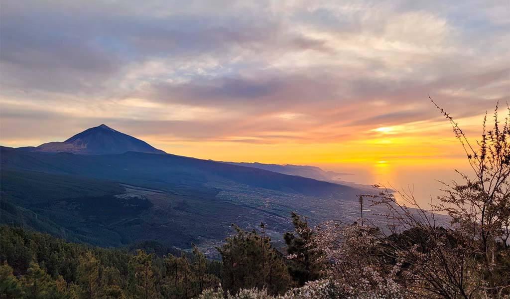
TENERIFE: In the north of Tenerife, cloudy skies with light showers will prevail, especially during the first and last hours of the day. In the rest of the island a mostly clear sky is expected, with intervals of medium and high clouds at the beginning and a low probability of occasional showers during the early morning, mainly affecting the higher areas.
In the afternoon, cloudiness will predominate in the west. Minimum temperatures will remain unchanged, while maximum temperatures will experience a slight to moderate decrease inland. The wind will be from the northeast, with intervals of strong on the east coast, on the southeastern slope and on the northwestern tip of Tenerife. On the central peaks, the wind will be southerly, light to moderate, and will turn north at the end of the day. Breezes will be recorded on the north and west coasts of the island.
MINIMUM AND MAXIMUM TEMPERATURES FORECASTED (°C): Santa Cruz de Tenerife: 19°C (minimum) – 24°C (maximum)
LA GOMERA: In the north of La Gomera, cloudy skies with generally light showers are expected, more likely during the first and last hours of the day. In the rest of the island, the sky is expected to be partly cloudy, except for some medium and high clouds at the beginning of the day. Minimum temperatures will hardly change, while maximum temperatures will experience a slight decrease inland.
The wind will blow from the northeast, with strong intervals on the eastern and northwestern slopes, without ruling them out inland towards the end of the day. On the summits, the wind will be light and of variable direction, but will tend to be moderate to strong from the northeast towards the end of the day. Breezes will be recorded on the southwest coast.
MINIMUM AND MAXIMUM EXPECTED TEMPERATURES (°C): San Sebastián de la Gomera: 19°C (minimum) – 23°C (maximum)
LA PALMA: In the north and east of La Palma, cloudy skies are expected with generally light showers, more likely during the first and last hours of the day. In the rest of the island, a partly cloudy sky is forecast, except for some medium and high clouds at the beginning and some cloudy intervals during the central hours. Minimum temperatures will hardly change, while maximum temperatures will experience a slight decrease inland.
The wind will blow from the northeast, with strong intervals in the extreme southeast and northwest, and less likely in the El Paso area. At the summits, the wind will be light and of variable direction, but will tend to be moderate from the north in the afternoon. Breezes will be recorded on the west coast.
MINIMUM AND MAXIMUM TEMPERATURES FORECASTED (°C): Santa Cruz de la Palma: 20°C (minimum) – 23°C (maximum)
EL HIERRO: In the north of El Hierro, cloudy intervals are expected, increasing to cloudy towards the end of the day, with the possibility of light showers. The rest of the island is expected to be partly cloudy, except for some medium and high clouds at the beginning of the day. Minimum temperatures will hardly change, while maximum temperatures will experience a slight decrease inland.
The wind will blow from the northeast, with strong intervals on the southeastern slope and in the extreme northwest of El Hierro, without ruling them out inland towards the end of the day. On the summits, the wind will be light and of variable direction, but will tend to be moderate to strong from the northeast by the end of the day. Breezes will be recorded on the southwest coast of the island.
MINIMUM AND MAXIMUM TEMPERATURES FORECASTED (°C): Valverde: 14°C (minimum) – 17°C (maximum)