



The State Meteorological Agency Aemet has forecast a slight drop in temperatures in the Canary Islands, bringing some relief after several days marked by heat and haze. However, temperatures will remain high in some parts of the archipelago. Thermometers are expected to exceed 34°C again in mid-altitude areas of the south and south-east of the higher islands.
The light haze affecting the Canary Islands is also expected to ease as the day progresses. According to the forecast, visibility should improve during the afternoon, especially in Lanzarote, Fuerteventura and the south of Gran Canaria. Across most of the islands, skies will remain mostly clear. The main exception will be the northern coastal areas, where patches of low cloud may appear at times.
Haze to clear during the afternoon
One of the most notable changes in Wednesday’s forecast is the gradual disappearance of the haze. Although light airborne dust may still be present during the first part of the day, Aemet expects it to lift throughout the afternoon. The improvement will be more noticeable in the eastern islands and in southern Gran Canaria.
This means that Lanzarote, Fuerteventura and parts of Gran Canaria should see clearer conditions later in the day, after several days of hazier skies across the archipelago.
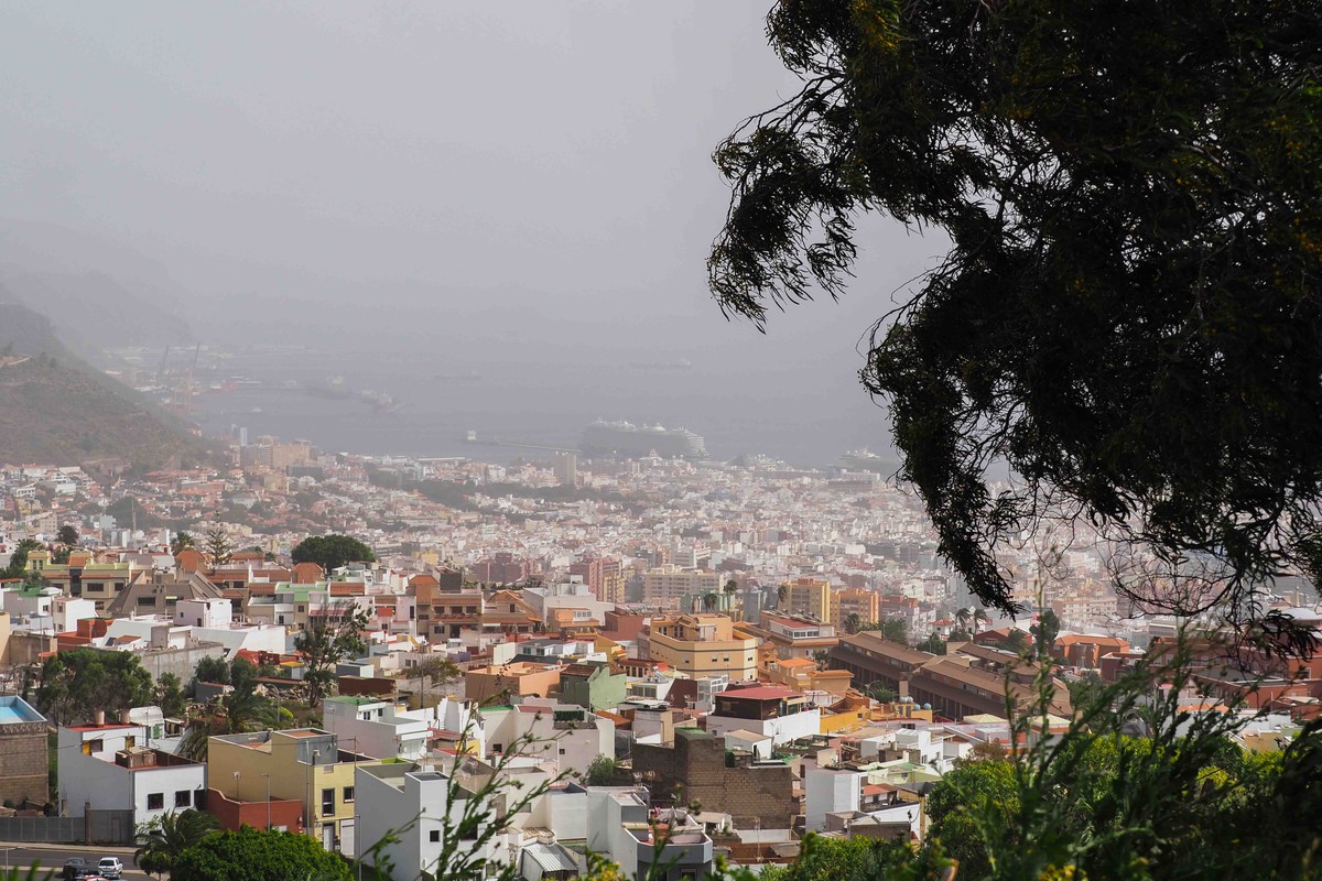
The clearing of the haze will coincide with a slight fall in temperatures, although the drop will not be enough to bring an end to the heat in the warmest inland and mid-altitude areas.
Temperatures remain high in mid-altitude areas
Despite the slight decrease forecast for Wednesday, temperatures will continue to be high in several parts of the Canary Islands. The warmest areas will once again be the mid-altitude zones facing south and south-east on the higher islands. In these areas, maximum temperatures may exceed 34°C.
Night-time temperatures will also remain warm. Minimum values will range from around 21°C in El Hierro to 25°C in Las Palmas de Gran Canaria. Maximum temperatures will reach around 30°C in the capital of Gran Canaria and up to 33°C in Tenerife, with higher values expected in the warmer mid-altitude zones.
The forecast therefore points to a gradual improvement rather than a complete change in weather conditions. The heat will ease slightly, but it will remain noticeable in inland areas and on slopes exposed to the south and south-east.
Mostly clear skies across the archipelago

Skies will remain mostly clear across much of the Canary Islands on Wednesday. The main cloud cover will be concentrated along the northern coastlines, where low cloud may appear at intervals, particularly during the early and later parts of the day.
In the rest of the archipelago, clear or lightly cloudy skies will dominate, especially as the haze begins to lift during the afternoon. The improvement in visibility will be most evident in the eastern islands and in southern Gran Canaria, where the presence of suspended dust is expected to decrease more clearly.
Light winds from the north and north-east
The wind will generally be light, blowing from the north to the north-east. Aemet expects the wind to strengthen slightly towards the end of the day, although no major wind episode is forecast in the available prediction. In the central mountain ranges, a light north-westerly wind will prevail.
Overall, Wednesday’s weather in the Canary Islands will bring a moderate improvement, with the haze gradually clearing and temperatures falling slightly. Even so, the archipelago will continue to experience high values in some areas, especially in the southern and south-eastern mid-altitude zones of the higher islands.