


A marked contrast in temperatures and the persistent influence of the trade winds will define the weather across the Canary Islands this Tuesday, 14 April, according to Agencia Estatal de Meteorología (Aemet). The day is expected to begin under unstable conditions, with the north-easterly airflow shaping both the thermal sensation and the distribution of cloud cover across the archipelago.
Aemet highlights the particular impact of these winds in elevated and exposed areas, especially on the higher islands, where gusts are forecast to reach significant intensity. This will result in notable variations in perceived temperature depending on altitude and orientation, reinforcing the sense of a changeable and uneven weather pattern throughout the day.
Cloud cover in the north, sunshine in the south
In the northern slopes of the mountainous islands, skies will remain predominantly overcast during the early hours and again towards the end of the day. These periods of thicker cloud may bring occasional light rainfall, mainly affecting mid-altitude areas. However, as the day progresses, clearer intervals are expected to develop, allowing for some sunshine around midday.
By contrast, the central highlands and the southern and eastern slopes will experience a much more settled outlook. Here, skies are expected to remain mostly clear or only lightly clouded, maintaining the more stable and pleasant conditions typically associated with the trade wind regime in these areas.
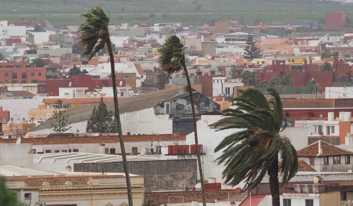
Strong winds intensify in exposed areas

Wind will be one of the defining features of the day. Blowing from the north-east with moderate to strong intensity, it will be particularly noticeable in the early morning hours, when very strong gusts are expected in high-altitude zones and at the north-western and south-eastern extremes of the islands.
These conditions may reappear later in the afternoon, especially in elevated areas of Tenerife and Gran Canaria. In contrast, the south-western coasts will benefit from more sheltered conditions, where lighter breezes will create a calmer atmosphere, offering a clear contrast with the more exposed regions.
Temperatures: a tale of two climates
Thermometers will reflect a mixed scenario across the archipelago. While minimum temperatures are expected to remain largely stable, maximum values will rise slightly in higher areas and on south-facing midlands.
Tenerife is forecast to record some of the highest temperatures of the day, with highs reaching up to 23°C. At the other end of the scale, El Hierro could see temperatures drop to around 11°C, particularly in higher zones, underlining the need for warmer clothing in those areas.
In Las Palmas de Gran Canaria, the temperature range will be more moderate, with values expected to fluctuate between 17°C and 20°C, reflecting the stabilising influence of the surrounding ocean.
Calmer outlook in the eastern islands

Lanzarote and Fuerteventura will experience more stable weather conditions overall. Skies will remain mostly clear or only lightly clouded, although some cloud intervals may appear during the early morning and late evening. The north-easterly wind will persist at moderate strength, maintaining a fresh and slightly cooler feel typical of this time of year.
In Gran Canaria, the north will continue under the influence of the well-known “panza de burro” effect, with persistent cloud cover and occasional sunny breaks around midday. Any rainfall will be weak, isolated, and mainly confined to mid-altitude areas.
Caution advised in exposed areas
Given this combination of strong winds, variable visibility, and changing temperatures, authorities recommend exercising caution, particularly on mountain roads and in coastal areas exposed to gusts. Early morning conditions, in particular, may present challenges for drivers and those engaging in outdoor activities.
Overall, Tuesday’s forecast paints a picture of a typically spring-like day in the Canary Islands—marked by contrasts, localised variability, and the ever-present influence of the trade winds.