


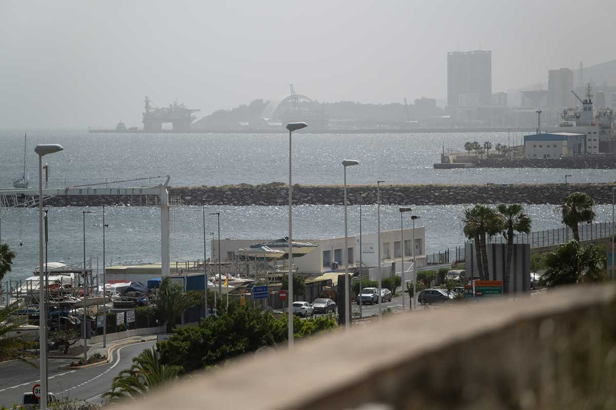
The Canary Islands are set to experience another day of demanding weather conditions this Sunday, as a combination of Saharan dust and high temperatures continues to affect the archipelago. According to the latest forecast from the AEMET, the presence of calima will remain a key feature, particularly in mid-altitude areas and on the summits of the more mountainous islands.
Haze, heat and largely stable skies
Despite the persistence of dust in suspension, skies are expected to remain mostly clear throughout the day. However, during the early morning hours, intervals of medium and high cloud may appear, especially over the central islands. In these initial hours, there is a slight possibility of light rainfall accompanied by isolated thunderstorms, although these would be brief and localised.
As the day progresses, conditions will stabilise, leaving behind a hazy atmosphere shaped by the calima. Visibility may be reduced in elevated areas, and air quality could deteriorate, particularly for sensitive groups.
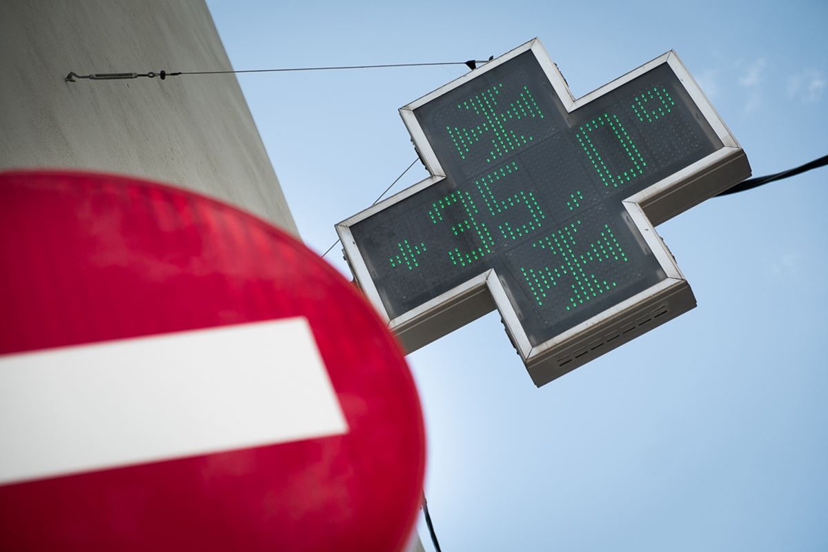
Temperatures climbing above 30°C

Temperatures will remain notably high for the time of year. In mid-altitude areas of Tenerife and across the eastern islands, thermometers are expected to exceed 30°C. In some inland and western parts of the eastern islands, temperatures could even reach or surpass 34°C.
This sustained heat continues to reflect an atypical pattern for spring, with values more commonly associated with the peak of summer.
Changing wind patterns with strong gusts at altitude
Wind conditions will vary across the islands. In low-lying areas, winds will generally be light to moderate from the east. As the day advances, particularly in the western islands, the direction may gradually shift towards the west.
In contrast, higher elevations and mid-altitude zones on the mountainous islands will experience stronger winds. Southerly flows are expected to dominate these areas, with moderate to strong intensity and the likelihood of very strong gusts, especially on exposed peaks.
Contrasting conditions across mainland Spain

Beyond the Canary Islands, unsettled weather will persist across large parts of mainland Spain, particularly in the north and north-east. Storm warnings have been issued for several regions, including Aragon, Castile and León, Catalonia, Navarre, the Basque Country and La Rioja, where heavy showers, thunderstorms, hail and strong wind gusts are expected during the afternoon.
Meanwhile, temperatures across the peninsula will remain generally high, exceeding 25°C in many areas and reaching 30°C or more in several provincial capitals. The highest values are forecast in Seville, where temperatures could climb to around 33°C.
A continued spell of unusual conditions

The outlook for Sunday confirms the persistence of an unusual weather pattern affecting the Canary Islands. The combination of calima, elevated temperatures and gusty winds at higher altitudes will continue to shape a day marked by reduced comfort and potentially challenging conditions, particularly away from coastal areas.
Meteorological authorities will continue to monitor the situation closely, as further variations in wind intensity and temperature cannot be ruled out over the coming hours.