


The weather in the Canary Islands this Saturday will bring a clear contrast between generally stable coastal conditions and more demanding weather in inland, mountainous and wind-exposed areas. According to the State Meteorological Agency (Aemet), the main feature of the day will be the strengthening of the trade winds, which will affect several islands with strong and, in some cases, very strong gusts.
Although much of the Archipelago will enjoy mostly clear skies, the situation will be different in higher areas, on exposed slopes and in parts of Lanzarote and Fuerteventura, where wind conditions may complicate outdoor activities. Residents and visitors are therefore advised to take extra care, particularly in mountain areas, on open roads, near exposed coastal zones and in places where the terrain tends to accelerate the wind.
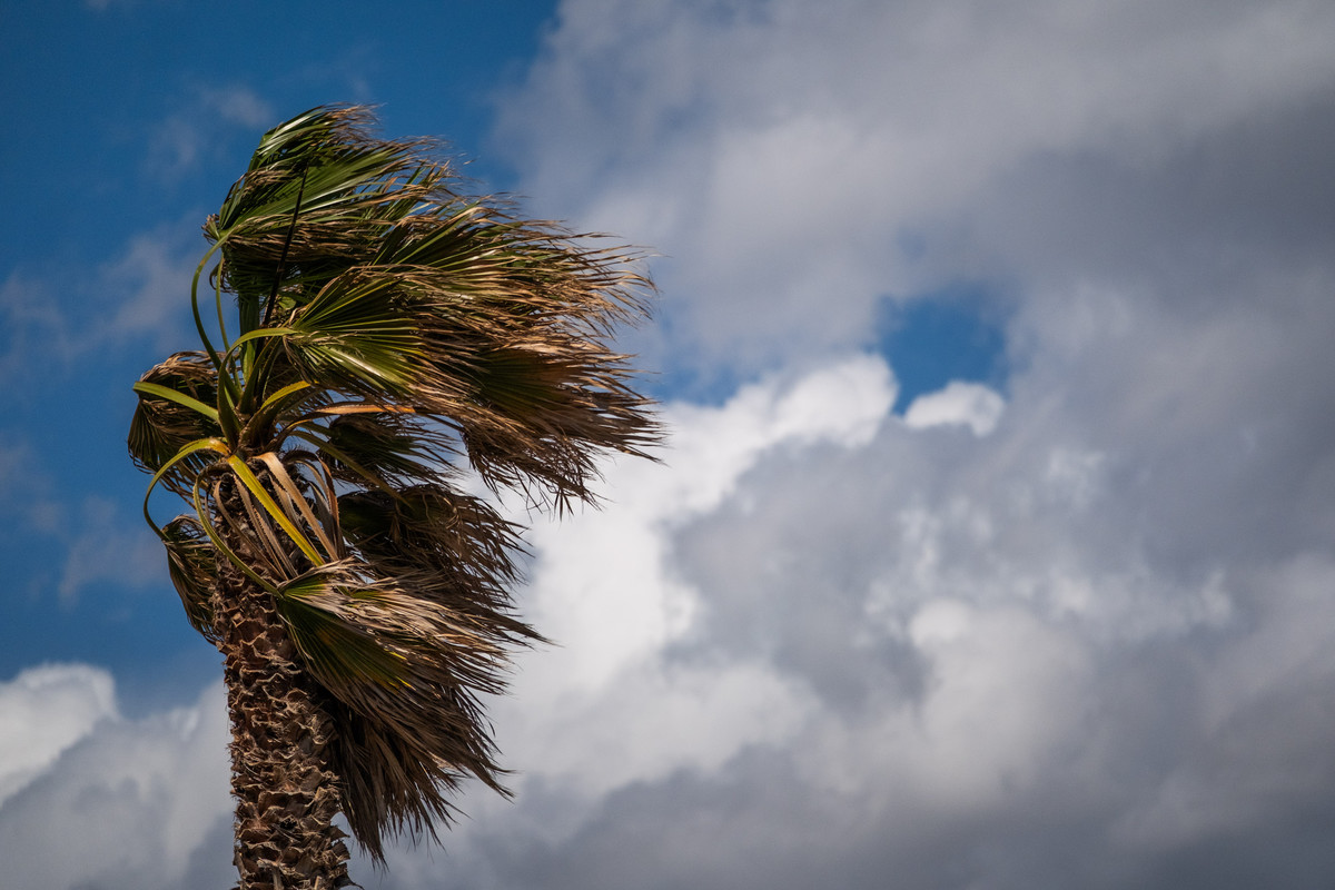
Trade winds and gusts above 80 km/h
The most significant weather risk this Saturday will be the wind. Aemet forecasts that the trade winds will blow strongly in the usual acceleration zones across the Canary Islands.
The strongest gusts could reach or even locally exceed 80 km/h, especially on the peaks and on the north-western and south-eastern slopes of the islands with the most mountainous terrain. These areas are traditionally more vulnerable to wind acceleration because of the shape and relief of the islands.
The strong wind will not be limited to high-altitude areas. The interior of Lanzarote and the southern part of Fuerteventura, particularly the Jandía peninsula, will also experience strong winds. These conditions may affect both work and leisure activities, especially those carried out outdoors.
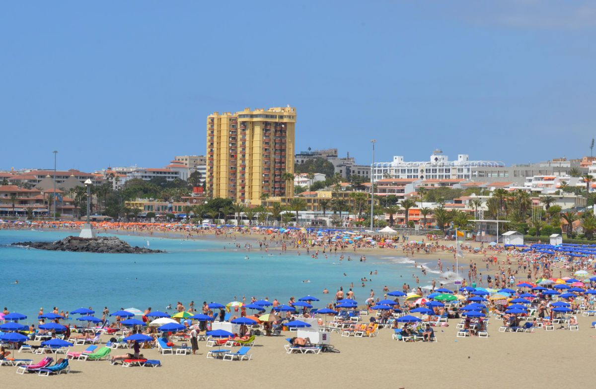
By contrast, the south-western coasts of the western islands and Gran Canaria will remain more sheltered. In these areas, coastal breezes will prevail, making conditions calmer than in the windier exposed zones.
Temperatures stable on the coast, warmer inland
Temperatures will show different behaviour depending on location. Along the coast, values will remain generally stable, without major changes compared with previous days.
Inland, however, the situation will be more varied. Maximum temperatures are expected to rise slightly to moderately, especially in mid-altitude areas facing south and south-east. These zones will feel warmer during the central hours of the day, particularly where sunshine is stronger and the cooling effect of the sea is less noticeable.
Minimum temperatures will remain largely unchanged, so nights will stay relatively cool compared with the warmer daytime conditions in inland areas.
Mostly clear skies, with low cloud in the north
Sky conditions will be mostly favourable across much of the Canary Islands. The general trend will be clear or almost cloudless skies, especially in southern and coastal areas.
However, low cloud patches are expected in the north of the Archipelago, mainly below 800 to 1,000 metres. These clouds will be most visible during the early hours of the morning and are expected to become more noticeable again towards dusk.
This pattern is typical of trade-wind weather in the Canary Islands, with more cloud on the windward northern sides and clearer skies in the south.
Tenerife: strong gusts in the west, south-east and Las Cañadas
Tenerife will see a generally clear day, although there will be cloudy spells in the north-east during the early morning and late afternoon. Maximum temperatures will rise in the southern midlands. In Santa Cruz de Tenerife, temperatures are expected to reach around 28°C.
The wind will be particularly relevant on the island. Very strong gusts are expected in the far west, the lower south-east, the southern edge of the metropolitan area and Las Cañadas National Park, especially during the afternoon. These areas will be among those where extra caution is advisable.
Gran Canaria: clear skies but very strong winds on the peaks
Gran Canaria will have mostly clear skies, with the exception of low cloud in the north below approximately 1,100 metres. Maximum temperatures will rise in the mid-altitude areas and in the south-east. In Las Palmas de Gran Canaria, the maximum temperature is expected to be around 23°C.

The trade winds will be especially strong on the western and south-eastern slopes. By the end of the day, gusts may exceed 80 km/h on the peaks, making higher areas and exposed roads particularly sensitive to wind conditions.
Lanzarote: strong wind inland and on southern slopes
Lanzarote will see cloudy intervals in the north and west at dawn and again towards dusk. The rest of the island will generally experience brighter conditions. Maximum temperatures will rise slightly in the south and east, with Arrecife expected to reach around 27°C.
The main concern will be the wind, which will blow strongly inland and on the southern slopes. Intense gusts are possible, so caution is recommended in open areas and on exposed roads.
Fuerteventura: sunny skies but strong wind in Jandía
Fuerteventura will be mainly sunny, although low cloud may appear in the north towards the end of the afternoon. In Puerto del Rosario, temperatures are expected to reach highs of around 27°C.
The wind will be strong in inland areas and on the Jandía peninsula, one of the zones most exposed to the trade-wind flow. Outdoor activities in these areas may be affected by gusty conditions.
La Palma: strong winds in the north-west, south-east and El Paso
La Palma will see mostly clear skies, with some cloud in the north and east. Temperatures will rise moderately in mid-altitude areas, while Santa Cruz de La Palma is expected to reach around 25°C.
Very strong trade winds are forecast in the far north-west, the south-east, the mountain areas and the municipality of El Paso during the morning. These areas may experience difficult conditions, especially in exposed zones and on higher roads.
La Gomera: strong gusts in the east, north-west and mountains

La Gomera will remain mostly clear, with some intervals of cloud in the north. Maximum temperatures will rise slightly in the south, with San Sebastián de La Gomera expected to reach around 26°C.
Strong winds will be concentrated in the east, the north-west and the mountain areas. Very strong gusts are expected during the afternoon, particularly in exposed locations.
El Hierro: cooler conditions but strong gusts in high areas
El Hierro will have mostly clear skies, apart from low cloud in the north. Valverde will see cooler temperatures, ranging between 14°C and 19°C.
The main weather risk will be the wind. Very strong gusts may affect higher summit areas and a very localised zone in the municipality of El Pinar.
Sea conditions also require caution
The situation at sea will also need close attention. Aemet forecasts north or north-easterly winds of force 5 to 6, which will generate moderate to heavy swell in many inter-island waters.
A northerly swell will also bring waves of between 1 and 2 metres. These conditions may make swimming inadvisable in unprotected areas of the north and north-east, especially where wind and waves combine.
Overall, Saturday’s weather in the Canary Islands will be marked by mostly clear skies, some low cloud in the north, slightly rising temperatures inland and a significant strengthening of the trade winds. The areas most affected by the strong wind warning will be the peaks, exposed slopes, parts of Lanzarote, southern Fuerteventura and several mountainous zones across the Archipelago.