


Unsettled weather continues to dominate across the Canary Islands, with no immediate sign of improvement. According to the latest forecast from the Agencia Estatal de Meteorología (AEMET), this Wednesday will be marked by persistent cloud cover, intermittent rainfall and a noticeable drop in daytime temperatures across much of the archipelago.
The deterioration in conditions will be particularly evident in the northern slopes and higher elevations of the more mountainous islands, where the combination of moisture, wind and lower temperatures will create a markedly cooler and more unstable atmosphere.
Cloud, rain and spreading instability
Throughout the day, skies are expected to remain predominantly overcast, especially in the northern areas of Tenerife, Gran Canaria and the western islands. These regions will experience light to moderate rainfall, which at times could intensify locally.
As the day progresses, this rainfall may extend towards the southern mid-altitude areas, particularly during the afternoon, bringing more widespread but still irregular precipitation.
In contrast, the eastern islands—Lanzarote and Fuerteventura—will see a lower probability of rain. Any showers that do occur are likely to be brief, isolated and concentrated mainly in the later hours of the day.
Wind intensifies, with strong and very strong gusts

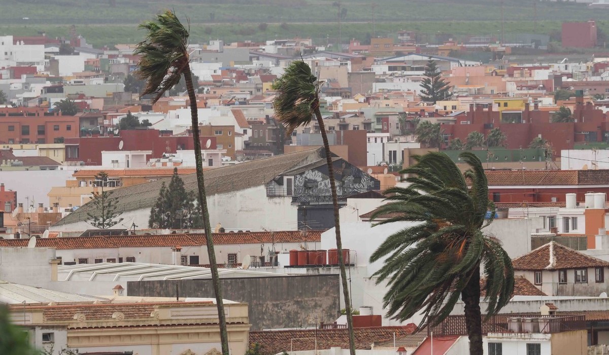
Wind will be another defining feature of the day. A generally moderate northerly flow will dominate, gradually shifting to the north-west during the afternoon.
However, AEMET warns that this general pattern will be punctuated by periods of stronger winds, including the possibility of very strong gusts in exposed areas. These gusts are most likely in:
- the Dorsal range of Tenerife
- the north-eastern mid-altitude areas
- the far north-west of the island
- the peaks of Gran Canaria
- exposed slopes of the western islands
In these zones, wind intensity may temporarily reach levels capable of causing disruption, particularly in elevated or open terrain.
Noticeable drop in temperatures and frost at high altitude
Temperatures will trend downwards across the archipelago, with a slight to moderate decrease expected overall. The drop will be more pronounced inland and at higher elevations, where the cooler air mass will be most noticeable.

On the central peaks, the decline in maximum temperatures could be significant. In Tenerife, light frost is expected in high-altitude areas around Mount Teide, highlighting the sharp contrast with the typically mild coastal climate.
Across the islands, temperatures will range from around 20°C in Santa Cruz de Tenerife to approximately 12°C in parts of El Hierro. In Las Palmas de Gran Canaria, values are expected to fluctuate between 16°C and 19°C.
Deteriorating sea conditions
Maritime conditions will also worsen as the day unfolds. Northerly winds of force 3 to 5 are expected, with stronger intensities—up to force 7—possible south of La Palma.
A north-westerly swell will build throughout the afternoon, with wave heights reaching between three and four metres. These conditions will make the sea rough to very rough, particularly along northern coastlines.
Authorities advise caution in coastal areas, where showers combined with reduced visibility may further complicate conditions.
Island-by-island outlook

- Tenerife: Cloudy in the north with intermittent rain. Significant drop in inland temperatures. Strong winds with very strong gusts on the Dorsal and mountain peaks.
- La Palma: Cloudy intervals with moderate rain in the north. Northerly winds turning north-west, with very strong gusts in exposed and high areas.
- La Gomera and El Hierro: Persistent cloud cover with rain affecting northern and mid-altitude zones. Stable minimum temperatures but falling daytime highs in elevated areas. Moderate to strong winds.
- Gran Canaria: Overcast skies in the north with light rain. Noticeable temperature drop, especially on the peaks. Risk of very strong gusts on eastern and western slopes.
- Lanzarote and Fuerteventura: Cloudy spells following an overcast start. Low probability of isolated showers later in the day. Moderate decrease in maximum temperatures.
A wintry interlude in a typically mild climate
Although the Canary Islands are known for their stable and temperate weather, this episode underscores the variability that can occur, particularly in transitional periods. The combination of rain, wind, cooler temperatures and even frost at higher altitudes creates a distinctly different atmosphere—one that calls for caution, especially in exposed, coastal and mountainous areas.