


The weather pattern across the Canary Islands is set to shift from this Thursday, 23 April, as more unsettled conditions begin to take hold over much of the archipelago. According to the latest forecast issued by AEMET, the day will be characterised by increased cloud cover and the likelihood of light to moderate rainfall, particularly affecting the central islands and the northern and eastern slopes of the higher terrain.
While no severe or high-impact weather phenomena are anticipated, the state agency does not rule out the possibility of locally persistent rain in certain areas. This could lead to periods of inconvenience, especially in outdoor activities or transport, as conditions may remain damp for extended stretches of the day.
Rain concentrated on the central and western islands

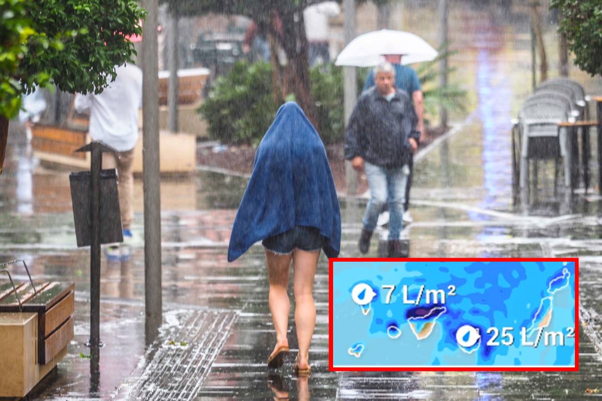
The distribution of rainfall will not be uniform across the archipelago. Islands such as Tenerife, Gran Canaria, La Palma, La Gomera and El Hierro are expected to experience predominantly overcast skies, with intermittent rainfall that may become more consistent in northern and eastern areas due to the influence of moist trade winds.
By contrast, the easternmost islands—Lanzarote and Fuerteventura—are likely to remain comparatively stable. Skies there will generally be clear to partly cloudy, although some cloud development is expected during the early morning and around midday. Isolated, weak showers cannot be completely ruled out, but any precipitation is expected to be minimal and short-lived.
Temperatures edge down slightly
Temperatures across the islands will remain relatively mild, though a slight downward trend is forecast, particularly in daytime highs. In the provincial capitals, conditions will stay stable but fresh:
- Santa Cruz de Tenerife: highs around 21°C, lows near 17°C
- Las Palmas de Gran Canaria: highs around 20°C, lows near 17°C
The overall thermal sensation may feel cooler at times due to cloud cover and humidity.
Northerly winds and moderate sea conditions
Winds will predominantly blow from the north, generally light to moderate in strength, with a tendency to intensify slightly during the afternoon hours. Coastal areas will experience relatively calm maritime conditions, with slight to moderate seas and north-westerly swell generating waves of approximately 1 to 2 metres.
Island-by-island outlook: Lanzarote

In Lanzarote, the day will begin with intervals of cloudiness, gradually clearing to partly cloudy skies as the morning progresses. Around midday, there is a small chance of light, scattered rainfall.
- Arrecife: temperatures between 15°C and 23°C
- Wind: light northerly, becoming moderate later in the day
Looking ahead: gradual improvement on Friday
By Friday, 24 April, a gradual stabilisation of the weather is expected. Northern areas of the higher islands may still see some cloud cover and occasional light rain, but overall conditions will begin to improve. Maximum temperatures are also forecast to rise slightly.
In summary, Thursday will bring a more unsettled weather scenario than usual for the Canary Islands. Although rainfall is not expected to be intense, it may accumulate in certain areas, particularly on windward slopes, making it a day where carrying an umbrella could prove advisable.